Descrizione
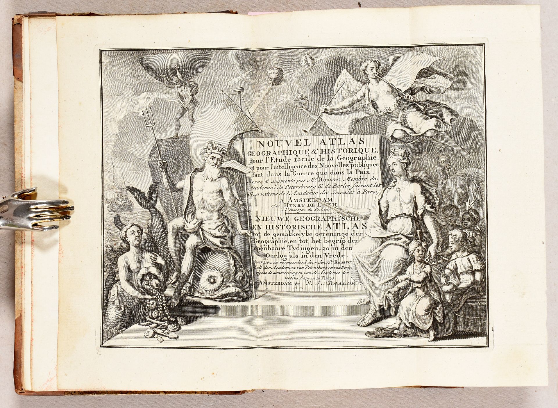
Nieuwe astronomische geographische en historische zak en reisatlas, tot klaar verstand en gemakkelyke oefeninge der geographie [...]. Amsterdam S.J. Baalde 1778 8vo: [2]-[148]-[54] pp.; front. and 41 maps, some part. hand-coloured (map of Europe: underlaid, map of Brabant: margins repaired). Contemp. half calf. Good copy. Complete copy of Baalde's pocket atlas. Engr. ill.: the bilingual title and 41 maps, incl. 5 terrestrial and celestial maps, 5 continental maps, 28 country or regional maps, 2 distance tables, 1 table with nautical pennants. Incl. next to the main text is a list of popes, emperors and kings. According to Koeman, Baalde carried on H. de Leth's pocket atlas after 1770, adding 2 maps of Brabant and Flanders, hence the name of de Leth is mentioned on the frontispiece. Ref. Koeman Le H 1. - Baa1B.
1073
Nieuwe astronomische geographische en historische zak en reisatlas, tot klaar verstand en gemakkelyke oefeninge der geographie [...]. Amsterdam S.J. Baalde 1778 8vo: [2]-[148]-[54] pp.; front. and 41 maps, some part. hand-coloured (map of Europe: underlaid, map of Brabant: margins repaired). Contemp. half calf. Good copy. Complete copy of Baalde's pocket atlas. Engr. ill.: the bilingual title and 41 maps, incl. 5 terrestrial and celestial maps, 5 continental maps, 28 country or regional maps, 2 distance tables, 1 table with nautical pennants. Incl. next to the main text is a list of popes, emperors and kings. According to Koeman, Baalde carried on H. de Leth's pocket atlas after 1770, adding 2 maps of Brabant and Flanders, hence the name of de Leth is mentioned on the frontispiece. Ref. Koeman Le H 1. - Baa1B.